Oceans, Ships and Data Science
What comprises the water sector? If you asked ten people working in the sector, you’d probably get ten different opinions! And that’s because there are so many aspects of working with water and water technology.
There’s drinking water - which involves figuring out how much water is available (water resources management), how to treat it, how to deliver it effectively and at an acceptable price to customers. Then there’s wastewater - how do you treat, remove and recycle wastewater, both residential and industrial, to acceptable levels. Next, we come to the interactions between water and other built systems - hydropower and irrigation being the largest. Then, there’s the impact of water-related disasters - floods and tsunamis for example. Finally, we’ve got natural resources management - where we explore, monitor and evaluate the condition of natural water bodies - lakes, rivers, glaciers and the ocean - and how they interact with other systems.
The fun part about working with water is that there are so many different ways that machine learning, robotics and data science in general can be applied used to solve problems. For example, let’s take a look at some of the applications that are being deployed in the ocean.
While there are many applications that look at what’s happening on the coast - monitoring tsuanmis, identifying and monitoring water pollution, modeling sea-levels and their impacts on coastal communities, siting and building offshore windmills - there are also a whole suite of applications associated with the ocean itself. And many of the these applications involve using machine learning, remote sensing and other data science tools.
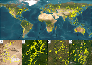
The most important of these applications is tracking the movement of ships on the ocean. This is necessary for understanding economic activity, monitoring the status of ports, identifying security threats on the oceans, monitoring fishing activity and overfishing and understanding ocean conditions. With Google Maps, it’s pretty easy to navigate our cities - but what happens with ships in ocean? Ocean shipping forms an integral component of our economic activity and figuring out the movement of ships and tankers is essential to understanding and monitoring shipping activity. So, how exactly is that done? It’s done in a few different ways - first, using high resolution satellite data with image recognition algorithms that can identify ships in ocean imagery. Second, using radar data and the unique identification number of a ship to track it’s movement through the oceans. Third, using a combination of video surveillance, buoy sensors and other sensors to monitor what’s happening at ports and identifying changes.
This is just a single example of how data science can be used in the water sector. If you’re interested in learning more about the market for data science in water - the companies, countries, startups and jobs - join us on Wednesday, November 11th at 10 am Pacific Time for a live webinar where we’ll be discussing these questions and more.