Reopening National Parks During the Pandemic - When Remote Sensing Can Help
It was great to meet so many folks at our live workshop session on Sunday - there were a lot of questions and we had fun in our hands-on problem - working through identifying the Camp Fire and estimating the damage it caused from remote sensing data. If you missed it and are curious about remote sensing, you can still sign up for the online course and other courses here. All the material that we cover in the live workshop, including our hands-on problem, is available in the course.
So today, let’s take a look at some of the latest research on building models from remote sensing data and see how these models can help us navigate the impacts from reopening high-value tourist destinations in the pandemic.
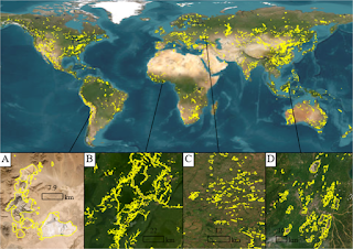
With all the data available from remote sensing hardware, one of biggest questions facing scientists and engineers working in the clean tech sector is - which data source is the most effective in solving the problem? In some cases, the answer jumps out right away - for example, when the spatial resolution from satellite data isn’t sufficient - so drone or UAV data is required. In other cases, there’s a lot of experimentation involved before that decision can be made - we have to explore the different data sources, figure out the resolution that’s needed to solve the problem at hand, look at whether combining different types of data would be useful and finally figure out how to build the models.
Let’s take a look at some of the data from a study in Norway that was conducted before the pandemic and see how the models and tools that were built could help us navigate reopening these high-value tourist destinations.
The main question in the study was understanding the impact of tourism on national parks in Norway. Now, this is a pretty broad topic - and one that was especially concerning in Norway as they were seeing more people coming in and using national parks over the last 5 years. National parks around the globe are areas where there a number of protected species and ecosystems exist - but also areas where people are visiting for recreation - to go hiking along the trails, boating, camping and backpacking. Having more people than the parks are designed for or having visitors in areas that are not built to accommodate large numbers could result in significant destruction of the habitat that we’re trying to preserve.
Now, traditionally, rangers and park officials manually visit different areas to estimate the damage and figure out where restoration is most important and how much money, manpower and materials need to be allocated. The question was - could the impact of visitors to these protected areas be monitored remotely, so that resources could be directed faster and more efficiently to the areas where they more most needed?
Enter the drones! The scale at which the damage needed to be estimated was much smaller than the data available from the best satellites today. So, it was a pretty easy decision as far as choosing the type of data - it had to be drones or unmanned aerial vehicles (UAVs). Since it’s become easier and cheaper to fly a drone, the scientists decided to use a DJI Phantom 3 Standard drone (www.dji.com) equipped with a built‐in GPS unit and a 12MP camera. They used standard open source software to process the images by creating a mosaic of the drone images, generating the layers in QGIS and identifying damaged areas using a machine learning algorithm - a fairly time consuming process! And then they compared the results with manual field inspections.
They found that of the 562 and 711 images that were taken in 2017 and 2018, there was no statistically significant difference between the areas that were identified as damaged in the manual inspections and the model that they built. Furthermore, they were able to identify wildlife droppings, see man-made fire pits and classify different types of vegetation with a high level of accuracy.
All of this suggests that drones can be used as a powerful aid to monitor what’s happening in a national park. Of course, there are limitations with respect to how long the drone can be flown without replacing the batteries, flight path and the presence of tree canopy as an obstruction to taking accurate images - but in general, they provide an accurate and powerful tool to help managers make decisions at the local level.
So, how does that help as parks reopen in the pandemic? There are several ways that drones can be used to monitor park use and what park visitors are doing. The most straightforward is in making sure that there are no large groups collecting around popular attractions - like Old Faithful geyser in Yellowstone National Park.
Another way would be to monitor trail use and camping use - to ensure that hiking parties are appropriately spaced as they use the trails and that campgrounds are adequately equipped and used. Then of course monitoring wildlife behavior as visitors reenter the parks! We’ve been observing bears, lions and other wildlife emerge from the protected areas as human visitors have been unable to use the parks. The big question is how these animals will behave as conditions change again! That’s something that drones could be used for — to make sure that there are no dangerous encounters between human visitors and wildlife - and if there are, to quickly figure out how to minimize and mitigate them.