Snippets in Clean Technology and Data Science: Urban Sustainability
Most of us working in the sustainability and clean tech space have heard of “Smart Cities” – one of the buzzwords in the clean tech and data science space since 2014. It’s usually used in the context of building better sensors or using artificial intelligence so that certain aspects of living in cities become automated, efficient and sustainable. These could be a number of things – better waste management, more efficient lighting, energy efficient buildings across the city, increased green spaces, less water use and so on and so on…
As more of the world’s population starts living in cities, it’s critical that we make our cities as livable and sustainable as possible. And that means using all the latest tools at our disposal, especially the new methods by which data are collected and stored in the cloud today.
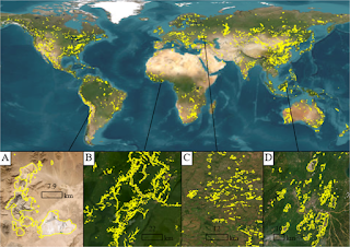
One of the most fascinating aspects of working in the data science space has been the explosion in data that are freely available or available at a relatively low cost as well as the sheer volume of data about all parts of the Earth. Today, we can look at Google Street View pictures of remote parts of our planet like Mount Kilimanjaro – something that was simply not possible a decade ago. Having all this data available means that we can now answer questions that were either too expensive to solve or just not feasible earlier.
One such question has been addressed by researchers in Switzerland . In the last decade, we’ve been breaking heat records and temperature records all across the globe. The sheer increase in the number of hot days as well as the increased number of heat waves is hard enough in countries where people have access to air conditioning and plentiful water. But what about countries in the tropics where air conditioning is a luxury and temperatures reach the high 100sOF? Is there a way by which we can design our tropical cities to keep them cooler?
The scientists decided to look at how trees in the cities were affecting temperatures and their surroundings and picked Singapore as their case study. And, in order to figure out where the trees were as well as the species and their effect of nearby houses, they used data from Google Street View. The algorithm they built used the shade from the trees as one of the parameters in calculating how much sunlight was falling on the house and they calculated the shade from Google Street View pictures.
What they found was that having trees reduced the solar radiation in the houses by upto 13% and that this changed based on the type of house (single family, multistory) as well as the tree species and age. So, if cities want to reduce their ground and air temperatures, they need to ensure that they have a large urban tree cover as well as neighborhood green spaces like parks. And not just that, but this kind of algorithm and tool are extremely useful in the community solar industry. It can tell us exactly how efficient a particular house is likely to be as a solar energy producer if solar panels were used.
Now, this is just the kind of problem and solution that was difficult to quantify in the clean tech field before we gained access to new datasets like Google Street View. It’s a wonderful example of integrating clean tech and big data in a way that delivers solutions for all of us today.