Snippets: Monitoring crop diseases, infrastructure health and wildlife
"If you can't measure it, can you fix it?"
One of the greatest challenges faced by almost everyone working in a clean technology field - water, agriculture, energy, climate, forestry, wildlife, soils, corporate sustainability, smart cities - is the challenge of monitoring. At its essence,this is the challenge of what needs to be measured, how often and how accurately can it be done.
Traditional methods of monitoring have involved sensors (of different levels of accuracy) placed in specific locations and the data removed and processed off-site by engineers and field analysts at specific time intervals. This is a time-consuming process, with data that isn't as frequent or as spatially dense or with as many parameters as decision makers and scientists would like - but, until recently that's been the best that we've had.
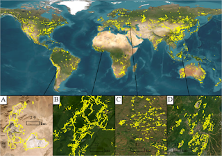
The advent of smartphones, high-frequency and high resolution satellite data and the whole Internet of Things (IoT) is changing this paradigm quickly. Now we have sensors that can be attached to smartphones, data from existing infrastructure that can be combined with new, high-resolution satellite or drone imagery from companies like Planet and a whole lot of interesting algorithms and ways by which data from different sources can be combined and machine learning algorithms deployed to find answers faster and more efficiently.
Today, let's take a look at some of the tech that's being developed and deployed in two different fields - agriculture and wildlife monitoring.
Researchers from North Carolina university recently developed a new application where a smartphone can be used to detect crop diseases - like the Irish potato blight, citrus greening and other pathogens. The crux of their innovation is that plants emit a range of chemicals called volatile organic compounds (VOCs) and the type and amount of VOCs they emit changes if the plants have a disease. So, how can these VOCs be measured efficiently? They developed a reader device (a sensor array consisting of organic dyes and nanocolorants) that can be attached to a smartphone. If a farmer suspects that a plant is diseased, they take a leaf from the plant, place it in a container with a stopper (test tube or jar) for 15 minutes and then use a narrow plastic tube and small pump to pump the air into the reader device. The device then changes color based on the levels of the VOCs and thus is an indicator of whether the plant is healthy or not. This was tested at in pilot trials at the University and tomato blight, which is a significant loss generator, for tomato farmers, was detected at greater than 95% accuracy.
That's a pretty amazing piece of technology - using a small, inexpensive sensor and the smartphone's image processing ability to detect a crop disease that can cause millions of dollars worth of damage at a very early stage. Of course, this was tested only for a single pathogen and a single plant, but the potential - both commercially and in helping mitigated pesticide use, is enormous.
The second piece of tech that we'll look at is how wildlife monitoring is evolving with the use of wearables. We've all looked at or used our smartphones or Fitbits or other sensors to monitor our health and movement. Now, scientists are using the same technology to monitor the movement and health of wildlife and make better decisions about how we can share our planet with the other creatures in our world.
Researchers at Oregon State University attached satellite transmitters to a small population of seals off the Oregon coast and monitored their behavior and movement over a year. They then mapped the data spatially, tagged it with known locations where the seals gather and found that while many members of the seal population like to frequent a small range, there were some individuals who were explorers and who ranged well over hundreds of kilometers and in fresh and salt water systems. This combination of spatial mapping, satellite monitoring and behavior monitoring hasn't really been studied for many ocean animals - so, not only is this novel in that sense, but it's also useful in helping us humans decide how to manage our streams and reservoirs better. After all, better data helps all of us!